 Analyzenn
Weather Forecast
Operation-focused marine weather forecasts covering wind, waves and visibility, so you can plan offshore interventions at the right time, safely.
Picking the right moment to operate
At sea, decisions are rarely made on the average. They are made on the window. Analyzenn produces operation-oriented marine weather forecasts that turn numerical model output into indicators you can act on directly, mapped to your operating limits: wind, significant wave height, wave period and direction, visibility.
Our scope
- Operational windows: identifying slots compatible with your operating limits and intervention durations.
- Wind and sea states: multi-model forecasts of wind, swell and wind-sea, with a clear read on uncertainty.
- Decision points: concise summaries at the lead times that matter, to support a go / no-go call.
What you get
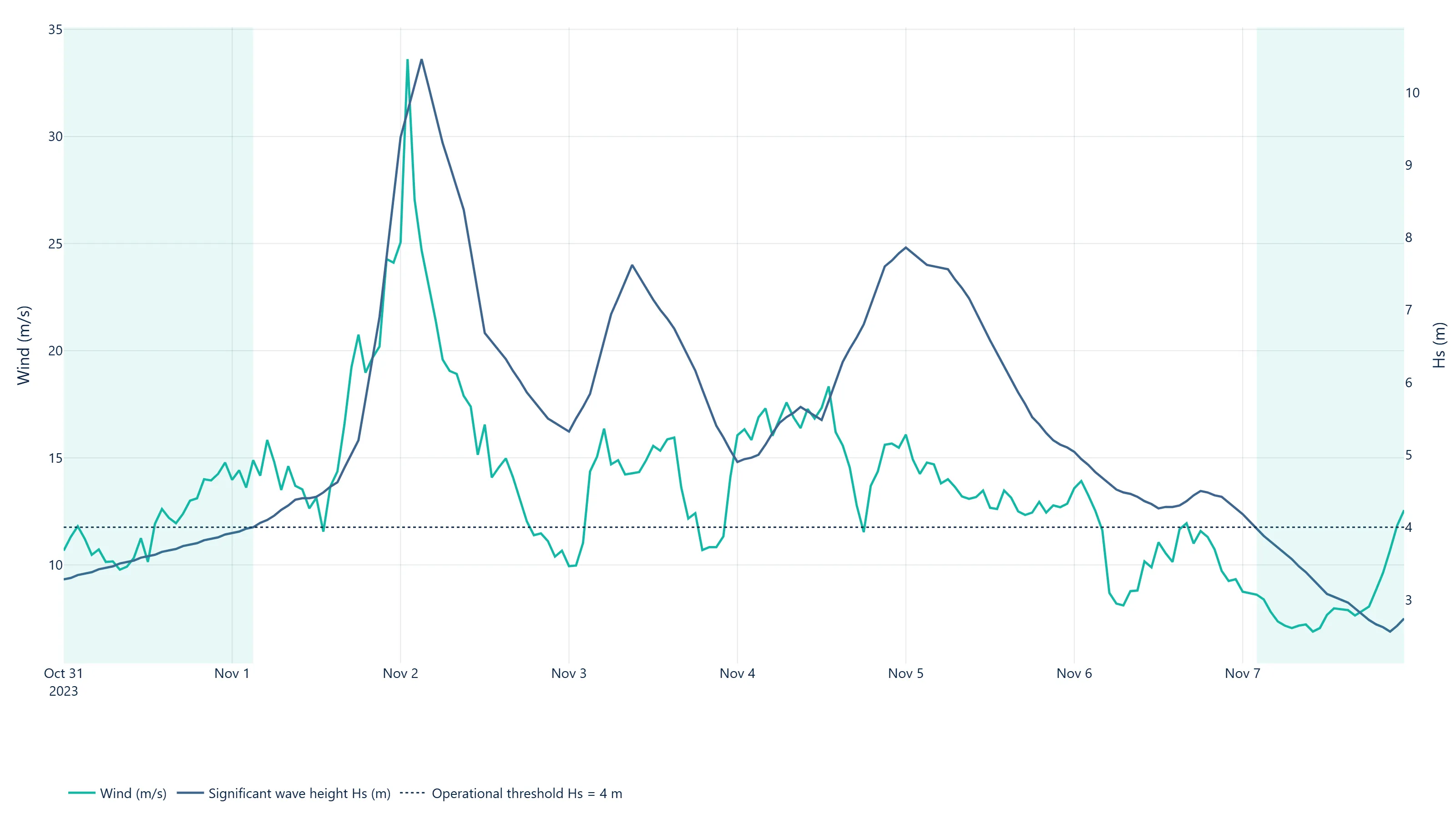
Readable deliverables (threshold tables, annotated time series, briefing notes) tailored to your site, your units and your operational language. The goal is not to hand you one more model, but a decision you can stand behind.
Which operations is it for?
Operation-oriented forecasts serve any intervention sensitive to sea state or wind: installation and maintenance of offshore structures, lifting operations, transport and towing, survey or marine works campaigns. You set the thresholds (significant wave height, wind, window length); we tell you when, and with what confidence, they will be met.
Method
The forecasts rely on several numerical wind and wave models. Comparing models measures their spread, and therefore the real uncertainty of the forecast, rather than relying on a single output. Results are then translated into the probability of staying within your thresholds for the required duration, not into average values that are hard to act on.
Frequently asked questions
How does it differ from a standard marine weather bulletin?
A bulletin describes the expected weather. An operation-oriented forecast answers a precise question: “can I carry out this intervention, of this duration, under these thresholds, and when?”. It is tailored to your site, your units and your decision criteria.
How reliable is a forecast several days ahead?
Reliability decreases with lead time. That is why we present uncertainty explicitly (spread between models) and focus the summaries on the lead times that matter for your decision, rather than delivering a single value that would give a false impression of precision.
What information do I need to provide?
The site position, the nature of the operation, its duration and your operating limits (for example maximum significant wave height, maximum wind, wave direction). The rest is settled together in a first discussion.
Can historical data be used for planning?
Yes. The statistics of past windows at a site, drawn from a metocean analysis, make it possible to plan and cost an operation upstream, even before forecasts are available.
Going further
See a concrete example: the weather window around storm Ciarán. To qualify a site ahead of the operation, see metocean analysis. A question about your project? Get in touch.
See this kind of result in practice: Weather window around storm Ciarán →